Hidden in Plain Sight: the John Nicholas Trail's Cultural Landscape
- Admin

- Mar 9, 2019
- 3 min read

Living on the San Francisco Bay Peninsula in the 70s and 80s meant that the Santa Cruz Coastal Mountains were not far away. Despite living near the base of these oak, fir, and redwood studded mountains today, their accessibility seems more distant. The mountains haven’t moved, of course, but back then my friends and I could bike after school up into the mountains then race back down without much concern for intervening motorists. Drivers on cell phones didn’t exist, and my calves looked great!

Today, that distance is fraught with dangers for cyclists; motorists are seeking similar thrills of racing along winding roads but with heavy horse power to ride. I cannot imagine taking those casual bicycle rides today, which makes the mountains more distant to me. True confession, age certainly plays its part in both my perception and ability. I have accepted my limitations long ago. So, if I am going to enjoy the detox that mountains have to offer, I will first need to strap down in a car and drive the snaking roads to the trail head.
We parted from the commuter traffic that was leaving Silicon Valley for homes along the coast. The road was distinctly smaller with steep drop offs right at the edge of the pavement. Still saturated from heavy rainfall this year, I was fully expecting a blockade from either a landslide tumbling onto the road or a washout taking the road with it. “Trees fall too ya know!” my aging brain reminds me. We parked at the trail head unscathed despite my reckless imagination.

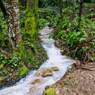
The John Nicholas Trail, well known among mountain bikers, is where I start my journey back into the Santa Cruz Mountains. Heavy February and March rains have soaked the trees and soil, so there is no escape as Mother Nature intends to drench us, too. The trail to the aptly named Lake Ranch Reservoir is both slippery and sticky. Exposed clay has such properties where a misstep will make your boot slide, but stand too long and the clay will want you to hang around a little longer. None of this trek is bothersome since the landscape is awakening from winter in its preparation for spring’s fertile beginning. Iridescent greens and oranges pop from the forest darkness; mosses, ferns, fungi, and salamanders are omnipresent. I slow to take photos, which helps me realize that the John Nicholas Trail is more than a recreational pathway.

Automobiles could drive the trail if it weren’t gated by county officials. At first, I thought this was for maintenance of the reservoir. This makes sense, and I could see recent repairs to diversion plumbing. But this reservoir predates its inclusion into the Sanborn County Park, so what was here before? The 2008 Sanborn County Park Trails Master Plan generally describes the area’s history, where “evidence of prior land uses and geologic events, such as large historic landslides, stumps from harvested redwoods, home sites, Native American sites, dams, canals, and even logging camps have been found.” I did not know this history while hiking, but the evidence is apparent to willing eyes.
Rusted pipes, abandoned farm equipment, a dug out area with remnants of a stone wall remain. So does the method for cranking down the diversion barrier that redirects the creek’s water to the reservoir…still in operation today. On this hike, the full reservoir was not receiving any more water, so the creek continues to flow downstream where it flows into Lexington Reservoir, Los Gatos Creek, and ultimately the San Francisco Bay. Amidst the debris of forest duff and fallen limbs is a pear-shaped depression lined with rock. A pipe jutting out from the middle suggests its former use as an ornamental pond with a fountain spray. This was somebody’s home, in the woods, by a reservoir with fresh fish for dinner.
It is difficult for me to not walk through a landscape and think, “What made this landscape?” Certainly, Mother Nature has her major role in this play, but there are so many subplots to this story of place. And like any great story, I want to read on and see where this leads.


Comments